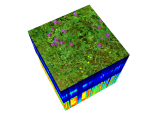
Instead of analyses for small areas , we can assess SOC for large areas using remote sensing methods In conjunction with process-based modeling, we can simulate the future change in observed areas

Instead of analyses for small areas , we can assess SOC for large areas using remote sensing methods In conjunction with process-based modeling, we can simulate the future change in observed areas
The project will use multisource data for the analysis. This includes:
UAV data collected in the study regions
EnMap time series
Sentinel 1 and Sentinel 2 time seires
Extensive field work is planned during the growing season of 2023 and 2024.
MoorGrünFE will work closely with ongoing projects at ZALF. In particular, close collaboration is planned with the IPP 2020 project (acquisition and modeling of water and carbon dynamics in wetlands), in which the MONICA model has been calibrated for a better process-based understanding of water and carbon dynamics in wetlands. collaboration is planned with the Klimamoor project, in which ZALF will provide scientific monitoring of lowland peatland rewetting measures.
Another project KIKompAg combines remote sensing products with various deep learning and mechanistic models as well as diverse surface and subsurface reference data sets for both cropland and grassland.
In addition, the MoorGrünFE project builds its expertise on previous projects. The project SattGrün focused on developing innovative products by combining satellite data and simulation models.
MoorGrünFE closely collaborates with external projects, for example a collaboration with HU regarding EnMap application.
